
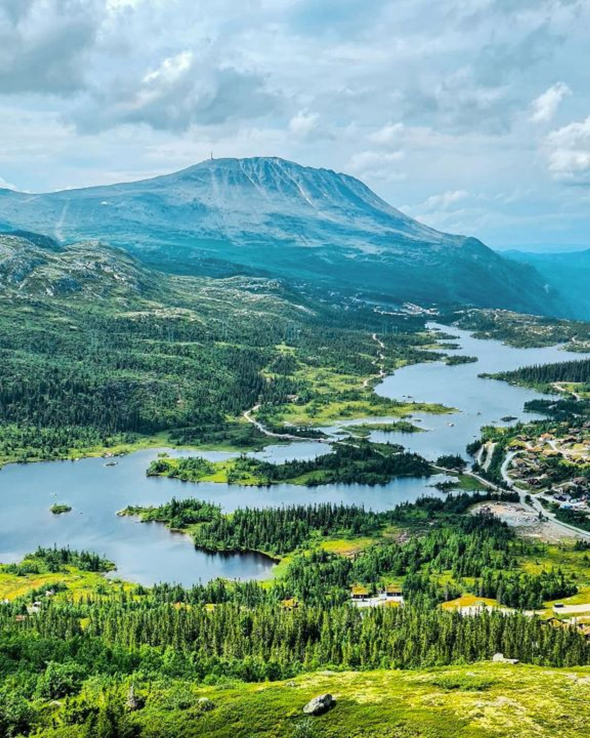
Hike to Toreskyrkja from Heddersvatn
This moderate hike to Toreskyrkja starts at Lake Heddersvatn next to Stavsro. The hike is 3,6 km and approximately 1–1,5 hours long (one way).
Hike to Toreskyrkja from Heddersvatn
This moderate hike to Toreskyrkja starts at Lake Heddersvatn next to Stavsro. The hike is 3,6 km and approximately 1–1,5 hours long (one way).
Hike to Toreskyrkja from Heddersvatn
This moderate hike to Toreskyrkja starts at Lake Heddersvatn next to Stavsro. The hike is 3,6 km and approximately 1–1,5 hours long (one way).
The route in brief
Start: By Lake Heddersvatn at Stavsro
Length: 7,2 km return
Time: 2-3 tim return
Vertical rise: 248 m (approx. 1,139-1,345 metres above sea level)
Difficulty: Medium
Child-friendly: For children used to hiking
MAP

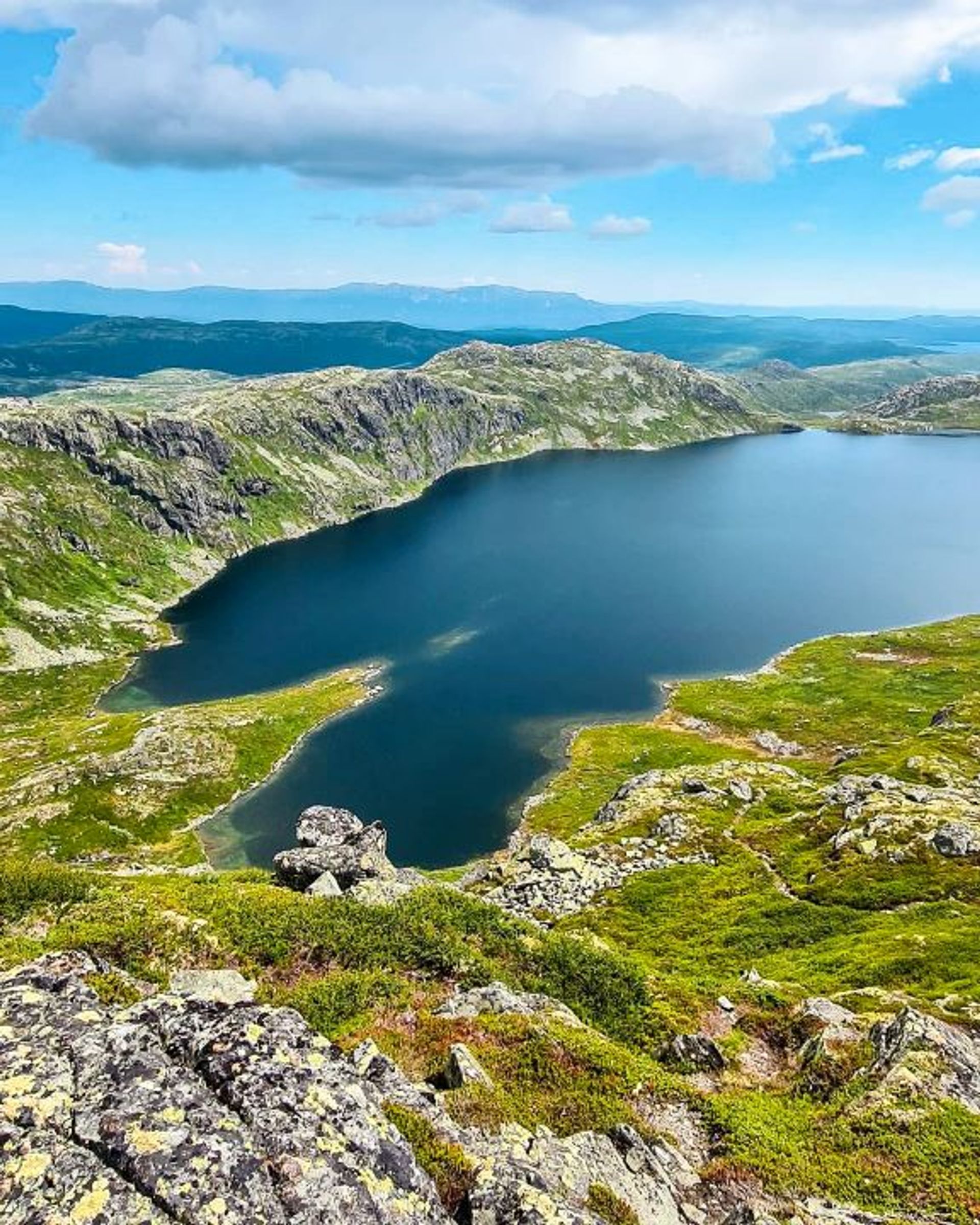
About Toreskyrkja
From the top at 1371 metres above sea level you will get a wonderful view towards Gaustatoppen, Tuddal and the mountains in south Telemark. Here you will also come across the more challenging red path from Lake Kvitåvatn.

Getting there
Park the car on the road next to Stavsro at the northern end of Lake Heddersvatn. From here, follow the small path eastwards on the north side of the lake. When you reach the valley and the first small lake, cross the small stream and turn right. The path from here up to Toreskyrkja can be quite rocky, so watch your steps and keep an eye open for the small cairns – they are there to lead you to the top!

Useful information
The hike from Lake Heddersvatn to Toreskyrkja is best in the summer and early autumn, from the beginning of June to mid-October.
As the hike includes a climb of a couple of hundred metres and rocky sections, it’s described as ‘medium hard’ – but it’s quite a simple hike for anyone used to hiking in the mountains.
Hikes on Gausta

Start: Pose & Sekk Grocery store
Length: 5.1 km round trip
Time: 1–2 hours
Child-friendly: Yes
Start: Vatnedalen, by the end of Kvitåvatn
Length: 4.6 km round trip
Time: 3 hours
Child-friendly: For children accustomed to hiking

Start: Heddersvatn/Stavsro
Length: 7,2 km round trip
Time: 2-3 hours
Child-friendly: For children accustomed to hiking
Start: Kvitåvatn/Vatnedalen
Length: 6,2 km round trip
Time: 4 hours
Child-friendly: No

Remember
Dress appropriately and follow the Norwegian mountain safety code, which is a set of rules and advice that you should always have with you when you go out in the mountains. For example, make sure that you always plan your hike carefully and be prepared for bad weather and the cold, even on short hikes.

Download the Gausta app
Would you like to download the map to your phone? Download the Gausta app from App Store or Google Play! The app also has plenty of other useful information for your visit to Gausta.


