
Hike to Ørnenipa fra Vatnedalen
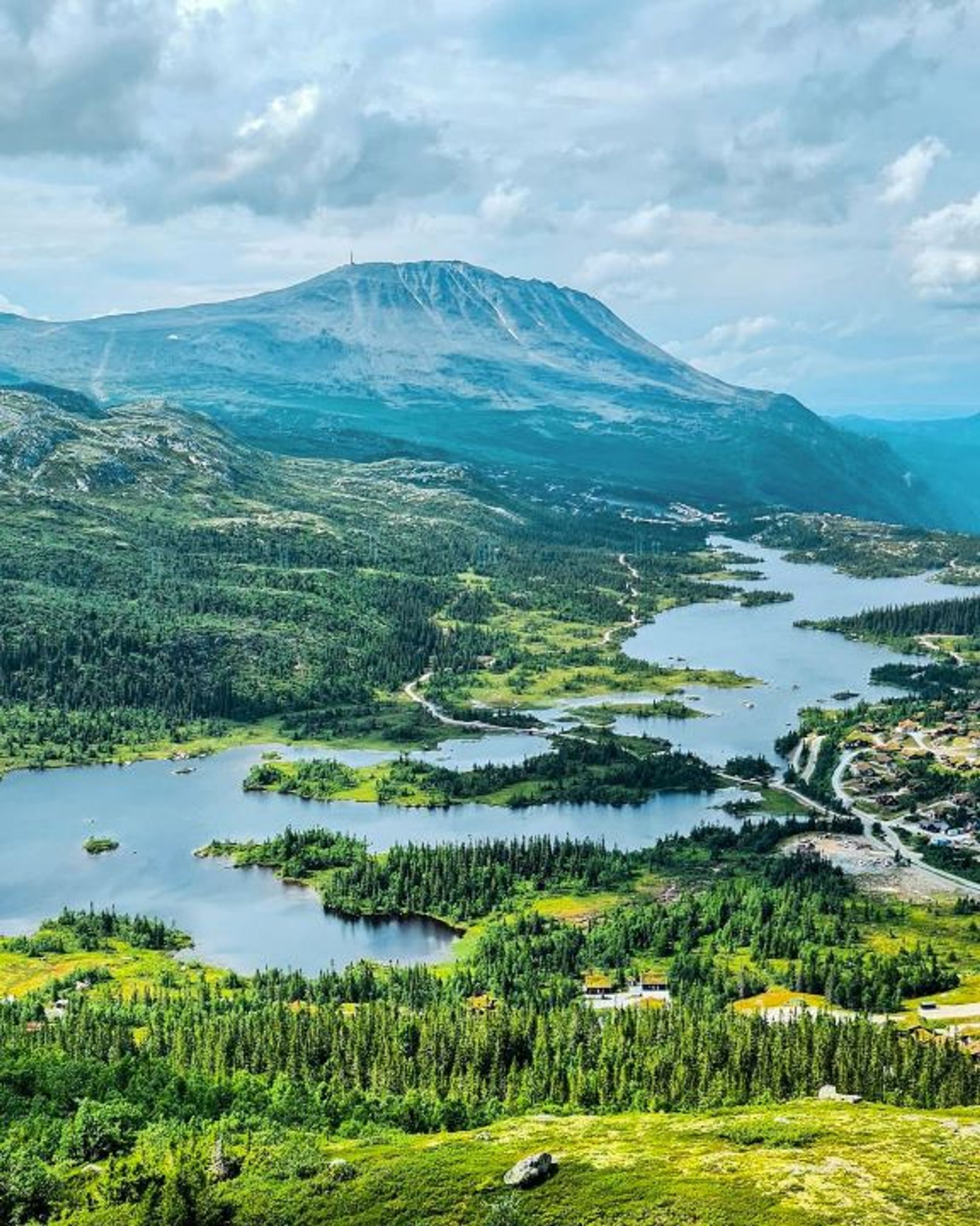
The hike from Vatnedalen to Ørnenipa follows a relatively simple hiking trail, around 3 hours return. The summit of Ørnenipa is 1,333 metres high and offers superb views of Gaustatoppen, Tuddal, and Tinnsjøn.
Hike to Ørnenipa fra Vatnedalen
The hike from Vatnedalen to Ørnenipa follows a relatively simple hiking trail, around 3 hours return. The summit of Ørnenipa is 1,333 metres high and offers superb views of Gaustatoppen, Tuddal, and Tinnsjøn.
Hike to Ørnenipa fra Vatnedalen
The hike from Vatnedalen to Ørnenipa follows a relatively simple hiking trail, around 3 hours return. The summit of Ørnenipa is 1,333 metres high and offers superb views of Gaustatoppen, Tuddal, and Tinnsjøn.

The route in brief
Start: Vatnedalen, at the end of Kvitåvatnvegen road
Length: 4.6 km return
Time: approx. 3 h return
Vertical rise: 359 m (approx. 956-1,315 metres above sea level)
Difficulty: Easy/medium
Child-friendly: For children used to hiking
MAP

Getting there
The mountain-top hike starts in Vatnedalen in eastern Gausta and is easy to get to from Gaustablikk. Follow Kvitåvatnvegen road east and park before the barrier at the end of the road. Continue by foot after the barrier, turn left into Vatnedalsvegen road, and follow the road to the top. Where the road ends, follow the hiking trail signposted red to the summit of Ørnenipa.
Or you could start the hike at Gaustablikk Fjellresort and walk to the barrier at the end of Kvitåvatnvegen road. Allow extra time if you do this.
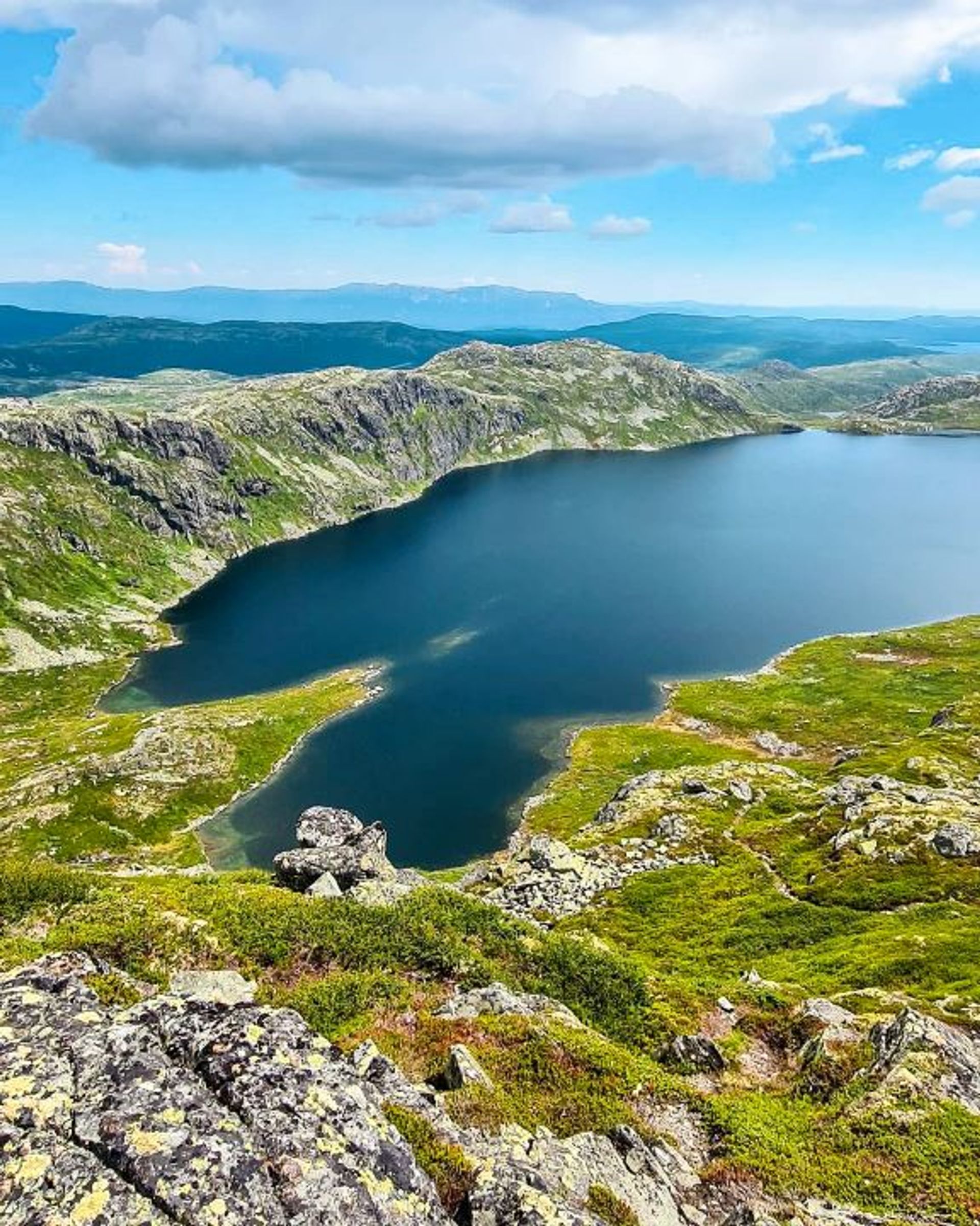
A magnificent view of Gaustatoppen, Rjukan and Vestfjord valley, Austbygde, Blefjell, and Lake Tinnsjön awaits you at the summit – and if you look carefully you can even see Mount Jonsknuten in Kongsberg!

Useful information
The best time to do the hike from Vatnedalen to Ørnenipa is from the beginning of June to mid-October.
The hike has a nice, even incline until the last 150 metres, when it gets steeper. The trail may also have some rocks, so it is best for people with some experience of hiking. The mountain-top hike is also suitable for families with slightly older children who are used to hiking.
The hike to Ørnenipa may include some rocky sections, so remember to wear sturdy hiking shoes, preferably hiking boots, with good ankle support.
Hikes on Gausta

Start: Pose & Sekk Grocery store
Length: 5.1 km round trip
Time: 1–2 hours
Child-friendly: Yes
Start: Vatnedalen, by the end of Kvitåvatn
Length: 4.6 km round trip
Time: 3 hours
Child-friendly: For children accustomed to hiking

Start: Heddersvatn/Stavsro
Length: 7,2 km round trip
Time: 2-3 hours
Child-friendly: For children accustomed to hiking
Start: Kvitåvatn/Vatnedalen
Length: 6,2 km round trip
Time: 4 hours
Child-friendly: No

Remember
Dress appropriately and follow the Norwegian mountain safety code, which is a set of rules and advice that you should always have with you when you go out in the mountains. For example, make sure that you always plan your hike carefully and be prepared for bad weather and the cold, even on short hikes.

Download the Gausta app
Would you like to download the map to your phone? Download the Gausta app from App Store or Google Play! The app also has plenty of other useful information for your visit to Gausta.


