

Hike to Lille and Store Gaustakne
On the ridge south of Gaustatoppen, you will find two beautiful hikes: Lille Gaustakne and Store Gaustakne. Read more here
Hike to Lille and Store Gaustakne
On the ridge south of Gaustatoppen, you will find two beautiful hikes: Lille Gaustakne and Store Gaustakne. Read more here
Hike to Lille and Store Gaustakne
On the ridge south of Gaustatoppen, you will find two beautiful hikes: Lille Gaustakne and Store Gaustakne. Read more here
The route in brief
Start: The highest point between Rjukan and Tuddal
Length: 3,2 km return
Time: 2 h return
Vertical rise: 184 m (approx. 1,249-1,409 metres above sea level)
Difficulty: Easy/medium
Child-friendly: Yes
MAP
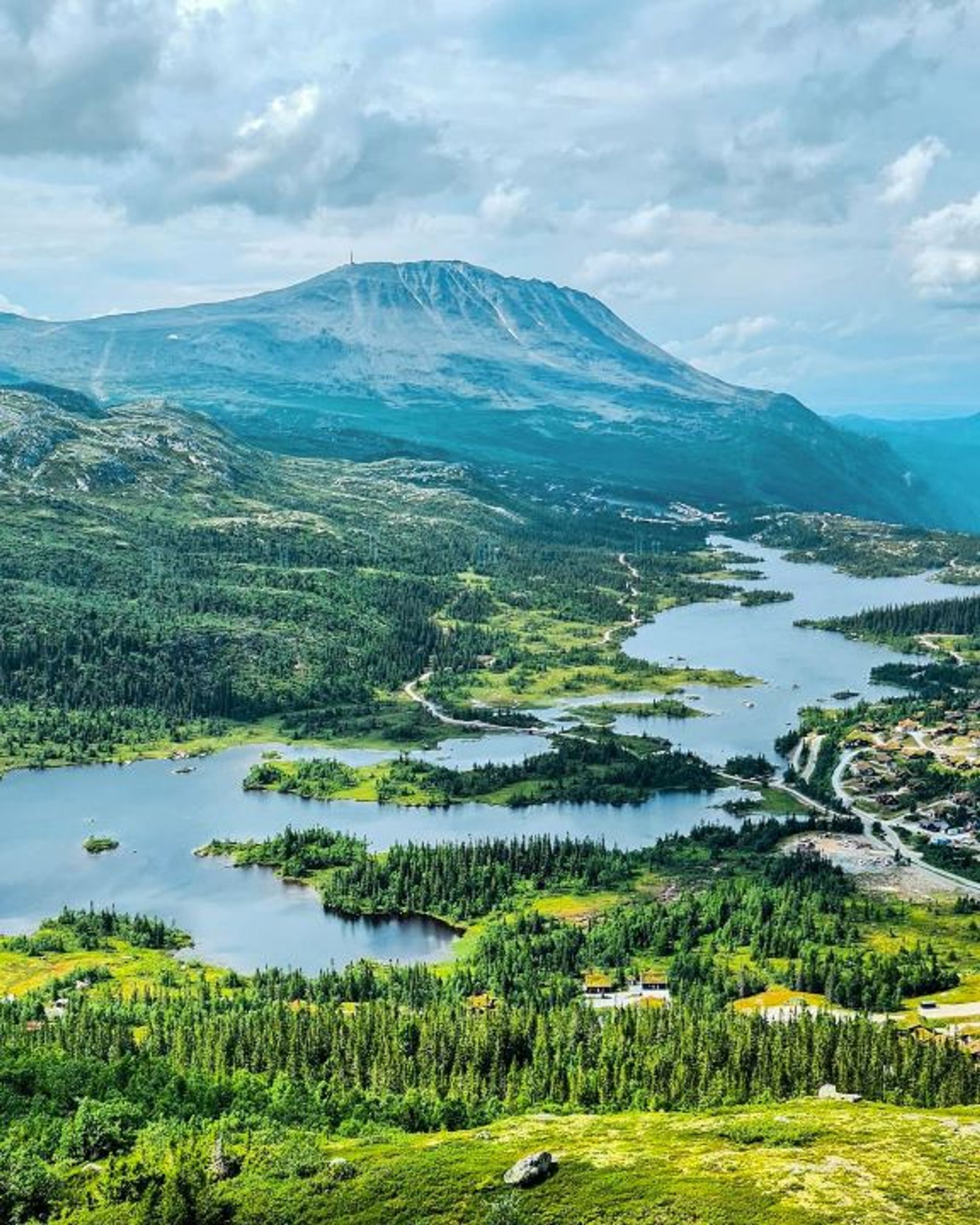
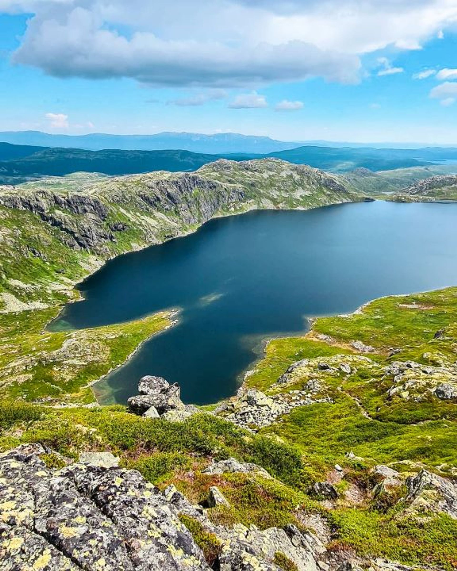
About Lille Gaustakne
Store Gaustakne and Lille Gaustakne, literally ‘Big Gaustakne’ and ‘Little Gaustakne’, are two mountain peaks south of Gaustatoppen. They are ideal for hiking and easy to reach from the road that runs between Rjukan and Tuddal.
Getting there
Go to Flistjønnskaret, the highest point on the road between Rjukan and Tuddal (near Stavsro). Around 50 metres further down on the left side towards Tuddal you’ll find a trail leading up to Lille Gaustakne.
Start the hike and turn right when the trail meets another trail. Continue right and follow the trail all the way to the top, 1,447 metres above the sea. From here there are fine views of the surrounding area, with the stately Gaustatoppen standing proud in the background.
Useful information
The best time to hike to Lille Gaustakne is in the summer and early autumn, from the beginning of June until mid-October. The hike does include an ascent but is suitable for most people, including families with children.
The route is in a high-altitude mountain environment with some rocky parts, known as ‘talus’ or ‘talus cones’. Sturdy boots or hiking shoes with proper ankle support are recommended.
Hikes on Gausta

Start: Pose & Sekk Grocery store
Length: 5.1 km round trip
Time: 1–2 hours
Child-friendly: Yes
Start: Vatnedalen, by the end of Kvitåvatn
Length: 4.6 km round trip
Time: 3 hours
Child-friendly: For children accustomed to hiking

Start: Heddersvatn/Stavsro
Length: 7,2 km round trip
Time: 2-3 hours
Child-friendly: For children accustomed to hiking
Start: Kvitåvatn/Vatnedalen
Length: 6,2 km round trip
Time: 4 hours
Child-friendly: No

Remember
Dress appropriately and follow the Norwegian mountain safety code, which is a set of rules and advice that you should always have with you when you go out in the mountains. For example, make sure that you always plan your hike carefully and be prepared for bad weather and the cold, even on short hikes.

Download the Gausta app
Would you like to download the map to your phone? Download the Gausta app from App Store or Google Play! The app also has plenty of other useful information for your visit to Gausta.


