
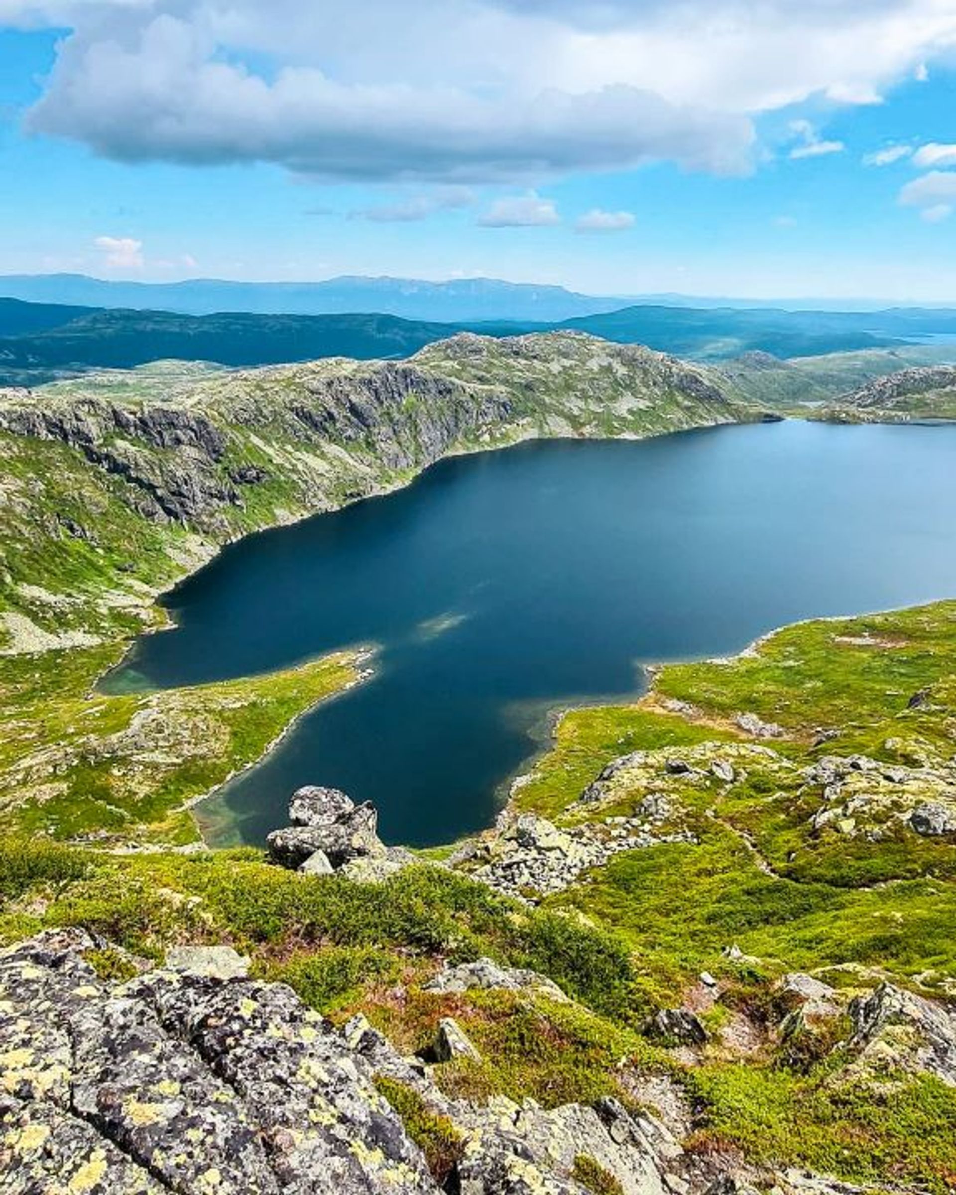
Hike around Skipsfjell
The hike around Skipsfjell is around 4.6 km and suitable for everyone, including families with children. From the top at 1088 metres, you can enjoy amazing views of Gaustatoppen and Rjukan.
Hike around Skipsfjell
The hike around Skipsfjell is around 4.6 km and suitable for everyone, including families with children. From the top at 1088 metres, you can enjoy amazing views of Gaustatoppen and Rjukan.
Hike around Skipsfjell
The hike around Skipsfjell is around 4.6 km and suitable for everyone, including families with children. From the top at 1088 metres, you can enjoy amazing views of Gaustatoppen and Rjukan.
The route in brief
Start: Pose & Sekk Dagligvare/Gaustablikk Fjellresort
Length: 4,6 km return
Time: 1–2 h
Vertical rise: 165 m (approx. 947-1,088 metres above sea level)
Difficulty: Easy/medium
Child-friendly: Yes
MAP
About Skipsfjell
Skipsfjell is a small mountain with big views of Gaustablikk. In the winter you can strap on your skis and take the Skipsheisen or Gaustablikkekspressen lift to the top. In the summer and autumn months, however, hiking is the name of the game.
Getting round
Start the hike at Pose & Sekk Dagligvare, right next to Gaustablikk Fjellresort. Follow the path on the mountainside of Gaustablikk Fjellhytter. Keep left and continue past the Tinnheisen and Vatnedalsheisen lifts. Turn left where the path divides and start climbing up the mountain for around 100-150 metres. From here simply follow the path all around the mountain until you’re back at Gaustablikk.
Make sure you stop to enjoy the views at the top of Skipsfjell. Arguably this is where you can get Gausta’s best views of Gaustatoppen and Rjukan.
(And remember to tag your pictures with #gausta!)
Useful information
The best time to hike around Skipsfjell is from early summer to late autumn, i.e. from the end of May until the end of October (depending on the weather conditions).
The hike is relatively easy and goes through easy terrain. This means that it’s suitable for families with children and more experienced hikers alike.
Hikes on Gausta

Start: Pose & Sekk Grocery store
Length: 5.1 km round trip
Time: 1–2 hours
Child-friendly: Yes

Start: Vatnedalen, by the end of Kvitåvatn
Length: 4.6 km round trip
Time: 3 hours
Child-friendly: For children accustomed to hiking

Start: Heddersvatn/Stavsro
Length: 7,2 km round trip
Time: 2-3 hours
Child-friendly: For children accustomed to hiking
Start: Kvitåvatn/Vatnedalen
Length: 6,2 km round trip
Time: 4 hours
Child-friendly: No

JOIN!
Virtual race around Skipsfjell
Make your hike a breeze! Download RaceONE and join the virtual race around Skipsfjell. You have to answer questions along the way and get around in time.
JOIN!
Virtual race around Skipsfjell
Make your hike a breeze! Download RaceONE and join the virtual race around Skipsfjell. You have to answer questions along the way and get around in time.
JOIN!
Virtual race around Skipsfjell
Make your hike a breeze! Download RaceONE and join the virtual race around Skipsfjell. You have to answer questions along the way and get around in time.

Remember
Dress appropriately and follow the Norwegian mountain safety code, which is a set of rules and advice that you should always have with you when you go out in the mountains. For example, make sure that you always plan your hike carefully and be prepared for bad weather and the cold, even on short hikes.

Download the Gausta app
Would you like to download the map to your phone? Download the Gausta app from App Store or Google Play! The app also has plenty of other useful information for your visit to Gausta.


